The Last Mile

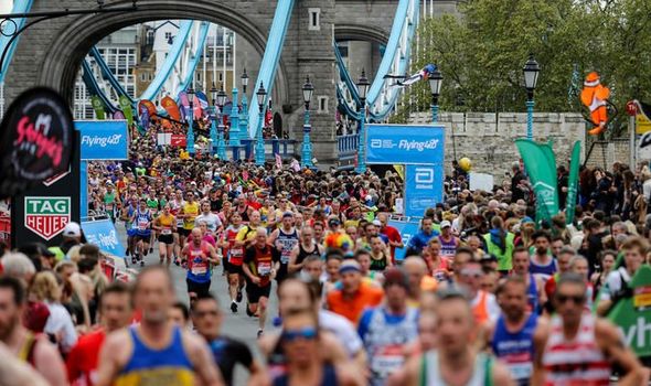
How fantastic was it to see the London marathon happening again recently? Not only the elite runners racing around the historic sites of London but the 10s of thousands of fun runners challenging themselves to complete this iconic event. Watching the runners going up the Mall with the pain on their faces, with the finish line in sight, must be an amazing feeling. Many runners struggle through the last mile, needing support from others to get to the finish line. They are helped over the line by other runners, encouraged and cheered by the crowd watching them make it to the finish line. This last mile can often be the most challenging.
Every year whenever I watch the London marathon, like many of us I’m sure who haven’t run this distance, I am inspired by the event. Every year I think, could I take part and run the marathon? I think about the preparation, the amount of training I would want to undertake, and the commitment. The end goal would certainly be a highlight, a fantastic achievement, and an experience remembered forever.
The approach runners take with taking on the marathon made me think about the comparisons to tasks, activities, and projects we undertake in our professional lives. Since qualifying as a chartered land surveyor and being in the geospatial industry for over 25 years, I know that planning, preparation, and ongoing support is essential for the successful completion of any project. Whether piloting new technology or undertaking business as usual tasks, without this, delivering goals, objectives, and outcomes from any task will always be more difficult, no matter what size. Like with the marathon, even with all the training and preparation, you need to be able to get through the last mile to the finish line, to deliver the results expected and achieve your goals. If you cant get through the last mile to the finish line would all the previous effort be worth it? Often this last mile is the most difficult and you need support from others. Very true in the marathon, with runners being helped through the last few steps, and motivated by the crowd cheering them to the finish.
In our professional life, whether you are working for a utility company or contractor, on an environmental or large infrastructure project, you don’t always have the crowd cheering to keep you going but support is there when it is needed. For field operations teams, designers, managers, and supervisors, MGISS can be there as your marathon support team, to provide the knowledge, expertise and capabilities to help you with these projects, not only to get through the last mile but with all the preparation and guidance along the way.
Completing the marathon has many other similarities to the services we provide at MGISS and the journey we take our clients on from location to insight. Helping with the preparation and design of your project, setting up the workflow to allow the successful delivery of the necessary information to the client. Thinking about the last mile, precision and accuracy are provided in our field solutions so that you can deliver exactly what is required. Not just 25 miles but 26.2 miles (or 42.195km). Solutions help our clients journey from location to insight, such as centimeter-accurate asset capture enabling the mapping and recording of the real-world location of assets, whether pipes and cables in the ground, street furniture, boundary lines and structures to name a few.
Solutions from MGISS allow you to capture assets accurately and easily. When the asset is aligned to Ordnance Survey base mapping for reference and context. As an example, an inspection chamber needs to show in the right place, the correct side of the road it is on, whether it is in the footpath or next to the verge. For critical assets, MGISS positioning solutions provide centimeter accuracy for drainage and utilities. Without this accuracy, how can you be sure the asset is mapped and recorded correctly?
When locating an asset, for an inspection task or in response to an emergency, without this geospatial accuracy, time would be wasted trying to find the asset. Getting to the right road or field is not good enough to find the asset. To get closer, using MGISS solutions to deliver improved location accuracy will help get closer without wasting time and money. This is especially important in areas with no other reference points to help. Imagine trying to finish the marathon when you can’t see the finish line?
Whatever your project or task, I encourage you to contact MGISS as early as possible in your project or activity planning. Our consultancy team and services will get you prepared, help you get started and support you along the way to achieve your objectives. Evaluating business requirements, advising on workflows, supplying solutions and training, all help to achieve the results required – not only achieve but exceed by speeding up implementation and delivery. This streamlines the approach taking some of the challenges away from the preparation, planning and training.
With all these thoughts of preparation and training, I’m off for a run outside and maybe one day you might see me running down The Mall towards the finishing line at the London Marathon.
About
Empowering your decision making with the asset data truth. Independently advising on the smarter use of Geospatial data, technology and the digital transformation of field operations.


