Digging into the Future: Why High-Accuracy Asset Data is Now Essential for Construction and Utility Contractors
Eamonn Prowse | 7 June 2024

The construction and utility sectors are on the cusp of a significant transformation. The National Underground Asset Register (NUAR) promises a centralised platform for underground asset data, streamlining communication and boosting safety. While wider access arrangements are yet to be finalised, one thing is certain:
Companies that invest in high-accuracy asset data recording now will be best positioned to capitalise on the NUAR revolution.
Why the Current System is Broken
As industry professionals, we all understand the complexities of navigating a network of buried infrastructure. The current system of fragmented data, often inaccurate and incomplete, leads to a multitude of problems:
- Costly Utility Strikes: Through user interviews, the Geospatial Commission found that, per year, 20,000 excavations are abandoned and 38,500 excavations face delays and resumption costs due to unexpected assets. These incidents not only pose a safety risk to workers and the public, but also incur significant repair and downtime costs.
- Inefficient Data Sharing: Obtaining accurate asset data can currently involve contacting numerous operators, with information provided in various formats and levels of detail. This time-consuming process hinders project planning and execution. The percentage of construction workers experiencing delays at work has increased by 6% since 2016.
- Safety Concerns: The lack of clear visibility into what lies beneath the ground creates a constant safety hazard. Construction projects are more susceptible to delays and accidents, impacting worker well-being and project timelines.
The NUAR Advantage: A Collaborative Future
The NUAR initiative aims to address these challenges by establishing a centralised platform for asset data. This will offer several key benefits:
- Risk Mitigation: Imagine a future where readily available, accurate data pinpoints the location and depth of underground assets. This empowers construction and utility companies to plan excavations meticulously, minimising the risk of costly utility strikes and ensuring worker safety.
- Enhanced Collaboration: NUAR fosters collaboration by providing a common data pool accessible to all stakeholders. This streamlines communication across different industries reduces the potential for conflicts and facilitates more efficient coordination of activities.
- Future-Proofing Infrastructure: High-quality asset data serves as a valuable resource for future infrastructure projects. With a clear understanding of the sub-surface environment, companies can confidently plan upgrades, expansions, and innovative solutions.

Taking the Lead: Proactive Investment in High-Accuracy GNSS
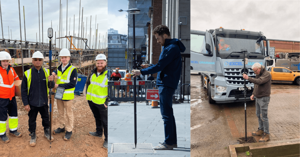
While NUAR will undoubtedly revolutionise the way we manage underground assets, there’s a crucial proactive step construction and utility companies can take today: investing in high-accuracy GNSS (Global Navigation Satellite System) technology.
GNSS equipment allows for precise recording of asset locations during design, construction, and maintenance projects. This data, when captured with high accuracy, becomes a valuable asset not just for your internal records but also paves the way for seamless integration with NUAR in the future.
The benefits of adopting high-accuracy GNSS are numerous:
- Improved Quality Assurance: By using GNSS, you gain immediate access to detailed asset information, ensuring accurate positioning and reducing the risk of costly accidents or delays caused by incomplete data.
- Enhanced Regulatory Compliance: Meeting stringent regulations becomes easier with high-quality asset data readily available. This empowers you to demonstrate compliance with confidence, avoiding potential fines and reputational damage.
- Streamlined Workflows: GNSS streamlines data collection, reducing the time and resources needed to acquire accurate asset information. This allows you to focus on core project activities and optimise workflows.
- Positioning for the Future: By taking the initiative and capturing high-accuracy asset data now, your company positions itself as a leader in adopting innovative practices. This not only enhances your reputation within the industry but also prepares you to seamlessly integrate with NUAR once it goes live.
Investing in high-accuracy GNSS is no longer a “nice to have” – it’s a strategic imperative.
Companies that embrace this technology today will be well-equipped to navigate the changing landscape of underground asset management. They will be able to minimise risks, increase efficiency, and collaborate effectively within the NUAR ecosystem.
Don’t wait for the future to arrive – start building it today. By proactively investing in high-accuracy asset data capture, you can ensure your company is at the forefront of a safer, more efficient, and collaborative construction and utility sector.
Remember, the ground beneath our feet holds valuable information. By capturing it accurately now, you can unlock a future of safer, more efficient, and collaborative infrastructure management.
Be among the first to get involved:
About
Eamonn brings 40 years' experience of working with spatial data. From early beginnings as a field surveyor to roles at Executive level, he has worked in public and private sectors in a career combining operations, technology and commercial experience with substantial international experience. He is sure to impress with deep expertise in geospatial data acquisition, data capture, data management, earth observation... the list goes on.


