Our location 53.38538, -2.97972
Our location 53.38538, -2.97972
Improved height and positional accuracy for ArcGIS Field Maps users
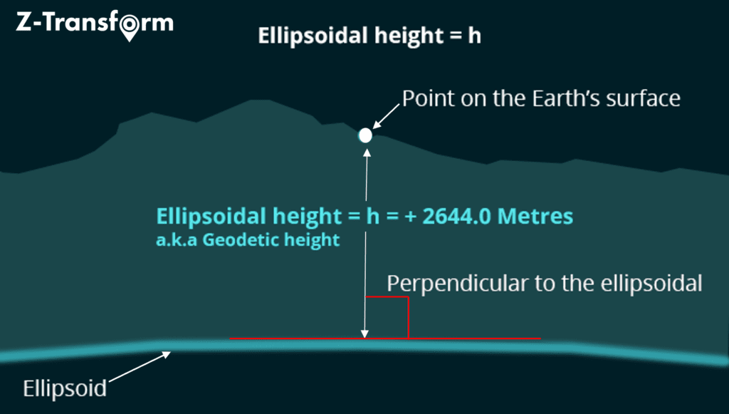
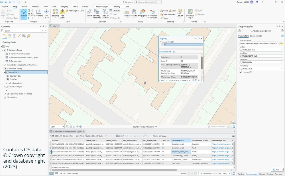
The automated MGISS Z-Transform solution enables three-dimensional (3D) asset data capture when using ArcGIS Field Maps to ensure asset information is accurately aligned with Ordnance Survey mapping.
When access to authoritative height information is of critical importance, MGISS Z-Transform removes the complexity of applying highly technical geoid model transformations by running the calculations in the background via a simple plug-in for ArcGIS Field Maps.Real-time GB GNSS (Global Navigation Satellite Systems) transformations are applied directly into your ArcGIS Online hosted Feature Service. This solution is incorporated in the Asset Capture pillar of the Location To Insight journey.
Download the Z-Transform Datasheet for more
Training programs can integrate into an employee’s workflow, helping them to learn as they work. We offer virtual training options and bespoke in-person, utilising the latest technology to improve productivity.
Our Training courses start from £295 per course.
We are flexible with how we support your business needs. We strive towards achieving the fastest response times from our UK support desk and engineers. We support hundreds of UK clients, maintaining their geospatial technology and keeping them productive. Our managed IT support helps you embrace technology that drives your business forward.
Choose from a range of business requirements. Support Packages include Lite, Standard, and Premium. Starting from £1,250 per annum.
