How Augmented Reality can be vital for locating buried assets.
Ed Coveney | 29 September 2022


Intro
Augmented Reality (AR) has the potential to revolutionise the way we see and interact with utility assets. It allows you to visualise assets that are hidden from the naked eye and give greater on-site awareness to those working with said assets.
Need
The Geospatial Commission has highlighted the following fact as a core reason for the creation of its National Underground Asset Register (NUAR):
The number of accidental strikes that occur each year in the UK has reached 66,000 and is estimated to have an annual economical cost of roughly £2.4 billion a year.
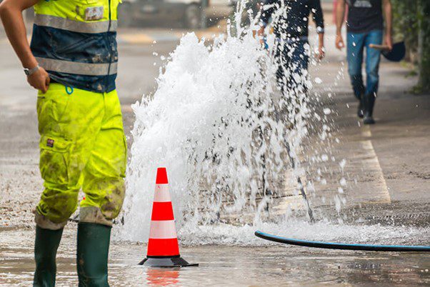
There is obviously a very high economic cost associated with accidental strikes but more importantly, is the human cost in terms of injuries and mortality. Research by the Energy Networks Association (ENA) (in 2020) stated that in the UK and Ireland from 2015 an average of 70 people per year had suffered life changing injuries after striking a live electricity cable. Nearly a third of tradespeople do not always check for sub-surface cables and incidents of strikes increased by 46% since the lockdown ended.
Statistics like this are additional drivers for Geospatial Commissions creation of NUAR and a has led to a renewed push for industry-wide improvements to geospatial data as well as finding new ways to utilise this data more efficiently both in the office and in the field. It is the hope of those who champion Augmented Reality in the utilities industry that AR apps such as vGIS can become one of the key tools in improving access to better location data and increasing on-site spatial awareness.
How AR Works
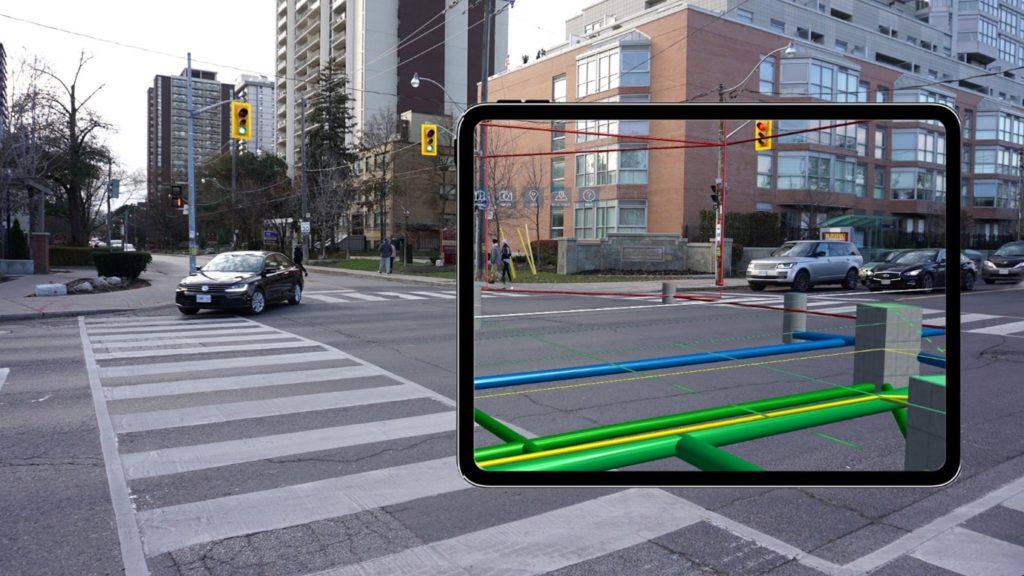
Augmented Reality Apps work by inserting 3D Spatially referenced data models onto a live camera feed of an AR-supported mobile or tablet device. The AR Apps will allow a user to view past, present, or future iterations of infrastructure as distinct 3D objects. These 3D Objects are locked in place, creating a digital twin of the real-life asset.
Most AR-based apps such as vGIS are designed to interface with 3D geospatial data from a wide array of different sources, including BIM 360, Bentley iTwin, Esri ArcGIS as well as other BIM CAD and GIS formats. Meaning that there is a more than likely chance that whatever data sources are preferred by a business, they can be consumed and rendered in AR.
How it can help
Gaining situational awareness can be critical for pre-dig and provide stakeholders with an impression of in-progress and completed construction projects. Traditionally this awareness is gained from using paper plans and trying to gauge your position relative to the 2D build and design models. This can be difficult, time-consuming and often these paper plans would be out of date and inaccurate. This obstacle can often lead to vital pre-dig checks being carried out.
Augmented Reality can be a valuable tool for giving on-site teams unprecedented insight into both the existing underground asset network and build designs by pulling in accurate 3D models to provide an immersive on-site experience.
How easy is AR and can it be trusted?
Using Augmented Reality is very simple however there are some caveats to achieving the best results:
- Model Accuracy – A pre-requisite of a successful AR implementation is model accuracy. An inaccurate position of your model in the real world will mean a mis-positioned model in Augmented Reality.
- Model Relevance – Models consumed by AR should be kept up to date. If a digital model has changed then this should be reflected in any AR app. vGIS supports several federated data repositories including ArcGIS Online/Enterprise, Bentley iTwin and Autodesk Build
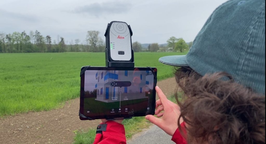
- Hardware – AR apps such as vGIS can likely be installed on the device in your pocket* however high spec phones/tablets are recommended due to the power and processing consumption. Pairing with high-accuracy GNSS receivers such as the EOS Arrow or Leica FLX100 is also recommended as this will provide a simple calibration method and stable AR visualisations over longer distances.
- vGIS Supported devices
Conclusion
AR applications can provide a unique view of your assets. For buried assets, the x-ray like vision gained through AR can be vital in assisting on site awareness. If used in conjunction with accurate data models and the right hardware configuration AR can be the ‘holy grail’ for site awareness.
MGISS are world leaders in this regard for shaping our customer’s journey from location to insight. With the help of our partners Esri UK and Eos Positioning Systems by providing world-leading asset location and asset capture solutions. Bring all this together and you can unlock the ultimate in-site asset insight.


