Utility providers and predictive asset management
Darius Mirdamadi | 14 October 2022


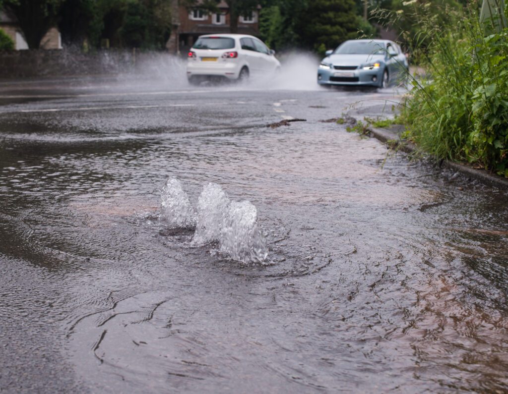
Utility companies have had a tough summer none more so than water providers.
Sewage – Check
Spills/leaks – Check
Water shortages – Check
Climate change equals hotter and dryer summers here in the UK. While many were basking in the uninterrupted heatwaves, other families were joining lengthy queues at water collection stations.
With reservoirs seriously low any additional sources of water loss due to leaks were going to be seriously scrutinised. The regulator OFWAT said that over the last 20 years £339 million has been collected in fines and penalties. Water companies lost an average of 2,923 million litres of water every day in 2021-22.
Add to this the scandals around missed pollution targets, and most can safely admit to having seen better days. It was announced by OFWAT that £150 million had to be dished back out to customers due to breaches in pollution targets.
Knowing where your assets are and how they will perform under different circumstances is key to making intelligent and informed decisions leading to better customer service and reduced fines/penalties.
A great example of world-leading GIS asset management is the award-winning Fire Flow System built by Stantec UK in Esri ArcGIS Online. With growing city populations, it is becoming harder for fire fighters to respond in the right way. There is a need to understand how much water is needed to fight specific blazes from building to building. Water companies in the UK have a responsibility to supply water to fight fires with each building having different water requirements based on the building volume/number of stories etc.
Creating a detailed digital twin of city buildings in ArcGIS Online including the water requirements of each building was key and paired with the water availability from water companies this allowed fire services to respond accordingly and make intelligent decisions that could save lives.
To get this kind of insight your asset management system should be relied upon for both its positional accuracy and completeness. The starting point is always accurate and thorough data capture. In the example above the water, supply zones must be accurately mapped on the ground. Capturing and maintaining a reliable asset repository is also key for predictive asset maintenance and ultimately reducing leakages and pollution spillages on the network.
MGISS are experts in creating seamless field-office workflows which empower your decision-making with asset data truth. This means capturing accurate asset data that can be relied upon for decision-making when it matters most.
About
With degrees in Geological Sciences and Geographical Information Systems, Darius has significant expertise and knowledge of Geospatial tech integration, specialising in high-accuracy mobile GIS deployment. Darius is the technical lead for IPAS and supports other large GIS-centric contracts in the utilities sector. Combining GIS development skills and years of customer insight he was able to create some of our leading solutions Z-Transform and DDMS for Highways.


