What is a Map Projection?
MGISS | 31 August 2023

Map Projections
Map projection is a technique used to display the spherical shape of the Earth on a flat surface. It’s a conversion of the 3D shape of Earth to 2D form. There are different techniques used for map projection. Every map projection must grow or diminish some characteristics—including size, shape, distance, direction, and/or scale—because the Earth is not flat.
To reduce these distortions and accurately convey information, cartographers select various map projections depending on the use and area of the map.
Types of Map Projection Distortion
Azimuthal Cylindrical and conic map projections are three of the most often used. All map projections alter the original data in some way, including the following:
Area-preserving projection, shape-preserving projection, direction-preserving projection, Distance-preserving projection. It’s crucial to remember that there’s no way to make a map projection that does the preservation of both properties at the same time.
Methods for classifying map projections
These are the most common types of map projections:
1. Cylindrical projections require enclosing the Earth inside a cylinder and then projecting the planet’s topography onto its cylindrical surface.
2. The second type of projection is called conic projection, and it involves superimposing a cone on the Earth and then projecting the Earth’s surface onto the cone.
3. Azimuthal projections, sometimes called planar or zenithal projections, map the Earth’s surface onto a flat plane that makes a single point of contact with the planet.
4. Pseudo-cylindrical projections are similar to cylindrical projections, except the meridians and parallels are curved instead of straight lines.
Projection maps can also be broken down according to the properties they preserve:
1. Equal-area projections are those in which the original ratios of area are maintained.
2. Conformal projection preserves the geometry of the original scene.
3. Equidistant projections keep the actual distances between any two sites in the projection.
4. Azimuthal projections are those that maintain directionality concerning a fixed origin.
5. Compromise projections aim to find a middle ground between the numerous distortions that might occur in map projections.
It’s crucial to keep in mind that no matter whatever form of map projection you use, some degree of compromise or distortion is unavoidable.
GIS Software and Map Projection
To study and fully understand how geography and geospatial data can benefit you and your organisation, MGISS provides all the tools, maps, and data you may need. MGISS is an award-winning Geospatial consultancy that can source solutions from across the industry and use our in-house expertise to meet your specific needs across all project types.
Spatial Analysis with MGISS
MGISS finds and analyses the geographical aspects of your data. We provide a wide variety of tools for studying trends, evaluating sites, and identifying the most direct paths to your business success. These tools aim to help people and groups plan routes better and make better decisions. You can learn a lot about the individuals who frequent your area of business and the terrain in which you operate by combining Census data with your data. Using this tool effectively can increase your knowledge of the market and the quality of your future choices.
In conjunction with tried-and-true geospatial tools, we take advantage of the most cutting-edge satellite positioning and data services available. MGISS has also developed user-friendly mobile apps that make use of accurate spatial data and asset information to give you an advantage over the competition.
We provide cutting-edge geospatial solutions that boost the reliability, effectiveness, and performance of our customers’ Utility, Infrastructure, and Environment offerings.
Map Projection Role In Infrastructure
Accurate geographic information obtained through map projection is crucial to the success of infrastructure planning, design, and management. Using a map projection in the infrastructure sector might be useful in the following ways:
Site Selection and Planning
Accurate map projections help in site selection and planning, allowing for more informed decisions about where to construct things like roads, bridges, buildings, and utilities. Planners may make intelligent choices regarding where to put things if they take things like distance, topography, and climate into account.
Engineers and planners may establish the most effective routes, transportation networks, and communication paths with the help of accurate map projections that allow for precise distance computations.
Utilities and Infrastructure Placement
Water, sewage, and power lines, among others, need to be placed precisely on maps to avoid disruptions and inefficiencies. The correct projection of maps helps plan the installation of these utilities and reduces the potential for disruptions during construction or maintenance.
Environmental Impact Assessment
Infrastructure developments frequently necessitate an environmental impact assessment. An accurate assessment of potential biological and environmental effects, regulatory compliance, and mitigation of undesirable repercussions is made possible with the use of geographical data provided by properly projected maps. Whether they are brand-spanking new builds or routine maintenance, we see to it that vital infrastructure projects are carried out with sustainability in mind.
Maintenance and Upkeep
After development is complete, infrastructure needs to be maintained and inspected frequently. Facility managers can monitor and schedule maintenance tasks more efficiently with the help of accurate maps, increasing the longevity of infrastructure assets.
What sets us apart?
Cost-effective Optimization of existing resources
We use cutting-edge technology to streamline operations, giving your engineers, field operators, contractors, and upper management access to accurate data. Our solutions work together to give you a complete smart asset management system, from discovery to analysis, at a price that won’t break the bank.
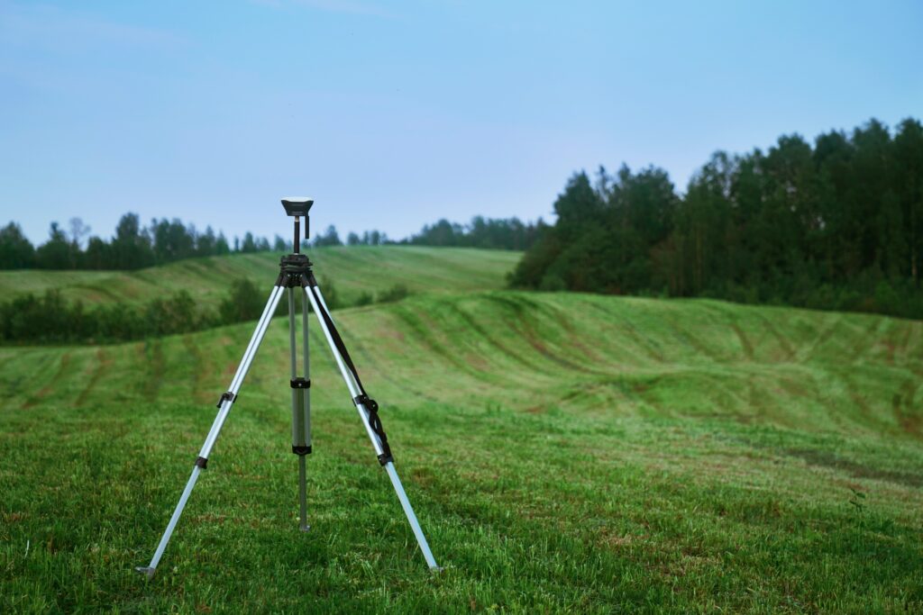
Pinpoint Asset Data Accuracy
The Global Positioning System (GPS) is the principal mechanism for recording asset positions in satellite positioning technology. With MGISS, you can have faith that your asset data is accurate to within 1 centimetre of where it is in the world.
Accurate and Authoritative Source of Data
We create a reliable corporate asset in the form of a trustworthy data repository. When it comes to Utility, Infrastructure, and Environment services, MGISS is the go-to provider for cutting-edge geospatial solutions that boost reliability, productivity, and safety for its customers. We make sure that all vital infrastructure projects, whether new or routine maintenance, are carried out with an understanding of the environment.
About
Empowering your decision making with the asset data truth. Independently advising on the smarter use of Geospatial data, technology and the digital transformation of field operations.


