Why we developed our CAD Transform plugin

The CAD and GIS worlds can sometimes seem at odds with each other.
CAD (Computer-Aided Design) is widely used by engineers, architects and designers and is perfect for design and modelling in both 2D and 3D.
GIS (Geographical Information Systems) can be used as a real-world spatial (geographic) asset repository. It is used to map, analyse, and understand spatial relationships, and is perfectly suited to industries such as urban planning/infrastructure, environmental management, and utilities.

Increasingly it is becoming apparent that the convergence of these two powerful technologies brings about an array of benefits, revolutionising the way professionals approach projects that involve both design and spatial analysis.
For instance, imagine a city planning project that involves designing a new road system. The CAD team would create detailed road designs, while the GIS team would assess the impact on traffic flow, access to amenities, and environmental considerations. Integrating these two workflows ensures accurate, up-to-date data is available to all stakeholders.
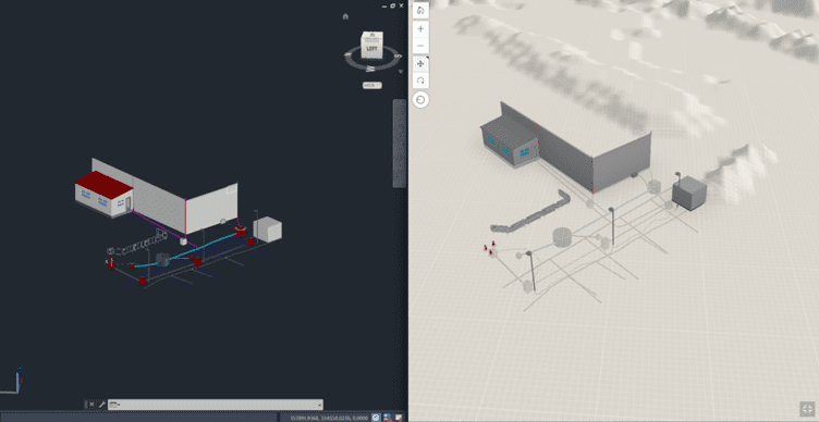
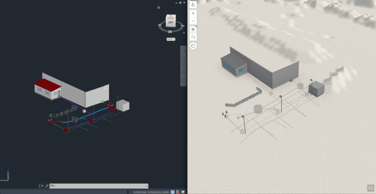
Our in-house Professional Services team developed CAD Transform to help busy professionals save time directly in ArcGIS, instead of using a range of manual and inefficient software for CAD to GIS conversion. Our development team comprises of GIS Consultants who recognise the difficulty in working on various projects, and tight deadlines and share frustrations with industry professionals in the lack of options to help speed up the file conversion process. This is where CAD Transform came in and after months of careful development, our team is proud to release our plugin which will be an essential tool in any CAD/GIS professional’s toolbox. Transforming and storing CAD models in the GIS world can help achieve this goal and with the ability to publish to the world-leading ArcGIS Online platform, you will have a single version of the truth instantly accessible to all members of your organization both back office and on-site.

Benefits of CAD Transform CAD-to-GIS Integration:
- Data Accuracy and Consistency: By linking CAD designs directly to GIS databases, discrepancies between design data and real-world conditions are minimised. This ensures accurate spatial information for analysis and decision-making. It is now also possible to use high-accuracy GNSS to capture As-Built records directly into the GIS and can be compared against the CAD-GIS converted drawings.
- Efficient Workflows: Integration reduces the need for manual data conversion, saving time and reducing the risk of errors. Changes made in the CAD environment can be instantly reflected in the GIS, streamlining the update process.
- Enhanced Collaboration: Teams from different disciplines can work more seamlessly together, fostering interdisciplinary collaboration. Stakeholders can access a centralised repository of information, reducing communication barriers.
- Spatial Analysis: GIS tools can be used to perform advanced spatial analysis on CAD data, providing insights into factors such as accessibility, proximity, and impact on the environment.
- Visualisation: Combining CAD’s intricate designs with GIS’s mapping capabilities allows for powerful visualisations that aid in communicating complex ideas to both technical and non-technical audiences.
Challenges and Best Practices:
- Data Standards: Establish consistent naming conventions to be used during any conversion
- Interoperability: As an Esri Silver partner we understand the power of their world-leading ArcGIS platform, but the ArcGIS Pro has some limitations regarding tools and available functionalities. For an extension to ArcGIS Pro/Online utilise MGISS’ CAD Transform plugin for ArcGIS Pro which streamlines the process, saves time, and adds flexibility.
- Training: Provide training to both CAD and GIS professionals to familiarise them with the integrated workflow and the tools they’ll be using.
- Scale Considerations: Understand the scale at which each software excels. CAD might be more suitable for detailed design, while GIS excels in analysing larger spatial relationships.
In conclusion, the integration of CAD and GIS technologies brings a new level of synergy to projects that require both design precision and spatial analysis. By eliminating barriers between the two domains, professionals can harness the power of accurate, up-to-date data for informed decision-making, leading to more effective urban planning, infrastructure development, and environmental management. If using Esri ArcGIS, then consider using the MGISS CAD Transform Add-In for ArcGIS Pro which enables seamless and flexible conversion from CAD formats to ArcGIS Pro/Online.
About
With degrees in Geological Sciences and Geographical Information Systems, Darius has significant expertise and knowledge of Geospatial tech integration, specialising in high-accuracy mobile GIS deployment. Darius is the technical lead for IPAS and supports other large GIS-centric contracts in the utilities sector. Combining GIS development skills and years of customer insight he was able to create some of our leading solutions Z-Transform and DDMS for Highways.


